Tag Archive for: Hiking

Eastern Gorge, OR — When the original Columbia River Highway (CRH) was built through this area in 1921, it was necessary to build two tunnels to get through a high rock point. These tunnels and the nearby cliffs were a troublesome spot on the CRH: rockfalls were common and accidents happened all too frequently. A new road was completed in 1954 near water level and the tunnels were abandoned. They were soon filled with rock rubble and forgotten.

A trip to the west portal in the early ’90s found the road near the tunnels completely buried in fallen rock, with trees growing in the roadway. Only a quarter of a damaged tunnel portal was visible. In 1995, work was begun to reopen the tunnels for tourist use. This involved the removal of the rubble, rebuilding and resurfacing the road. The area opened to tourist use in 2000. Today, the old highway is known as the Historic Columbia River Highway State Trail (HCRHT).

From the parking area, the path begins along the shoulder of Rock Creek Road, joining the old road about 0.2 miles down the hill. Walk through the gate and onto the old highway. The first part of the hike is through a large rock field, spotted with pine trees. The trail comes to the edge of the Gorge and turns west. Here, you’ll walk past stone guardrails and look down on Eighteen Mile Island. About a half mile from Rock Creek Road, a new stone-walled lookout has been built over the Columbia River. The grassy area around this lookout is a great place to see balsamroot and other wildflowers in April and May. Just past the lookout is the east portal of the east tunnel.

Kindness

www.resultsfitnesstraining.com

You’ll find milepost 72 inside the tunnel as well as carved graffiti from 1921, detailing the names of people that were trapped in the tunnel during a snowstorm. There are side passages leading to windows known as adits. West of the tunnels is a 700 foot structure designed to catch rocks falling from above. Beyond the tunnels, the trail continues another 4 miles to the Mark Hatfield West Trailhead, near Hood River.

History
Abandoned in 1954 with the construction of Interstate 84, these tunnels were filled in with rock and the road right-of-ways were reverted back to private owners. As Gorge legislation was being considered, thoughts of reconnecting the entire old highway gained momentum and the idea made its way into the National Scenic Area Act. Reconnecting the highway between Hood River and Mosier meant re-purchasing right-of-ways, closing several gravel pits and digging out and refurbishing the two tunnels. The highway and tunnels were finally reopened in 2000 as a result of hard work and generosity on federal, state, county and private levels. Consider biking this paved, 14-mile out-and-back (round-trip distance) section of the highway from Hood River to Mosier.

From gorgefriends

Little Huckleberry Trail Facts:

  • 5 miles/3 hour walk
  • West of Trout Lake in Gifford Pinchot National Forest

“One of the more accessible viewpoints from Highway 14, Little Huckleberry Trail makes a quick, and at times steep trip to an old lookout site,” according to the book, Washington Hiking: The Complete Guide to More Than 400 Hikes. “Views of Mount Adams and Mount Hood, across the Columbia River, are quite nice, and a feast of huckleberries along the way sweeten the deal on August trips to the mountain. This is a nice trail for a weekend morning, if you’re coming from from Vancouver or Portland.”

The trail gains 1,800 feet in just 2.5 miles, which makes it a steady and tiring ascent. Early in the summer, a cold-water spring runs two miles, which makes it a nice place to take a rest. There is room at the top of the trail to pitch a tent.

User Groups: The trail allows hikers, leashed dogs, horses, and mountain bikes. There is no wheelchair access.

Open Seasons: This trail is accessible April-November.

Permits: A federal Northwest Forest Pass is queried to park here.

Directions: from Vancouver, drive east 70 miles on Highway 14 to Highway 141. Turn north and drive 22 miles to Trout Lake. Continue north on Highway 141 as it becomes Forest Service Road 66. Turn left (south) and rive five miles to the trailhead on the left.


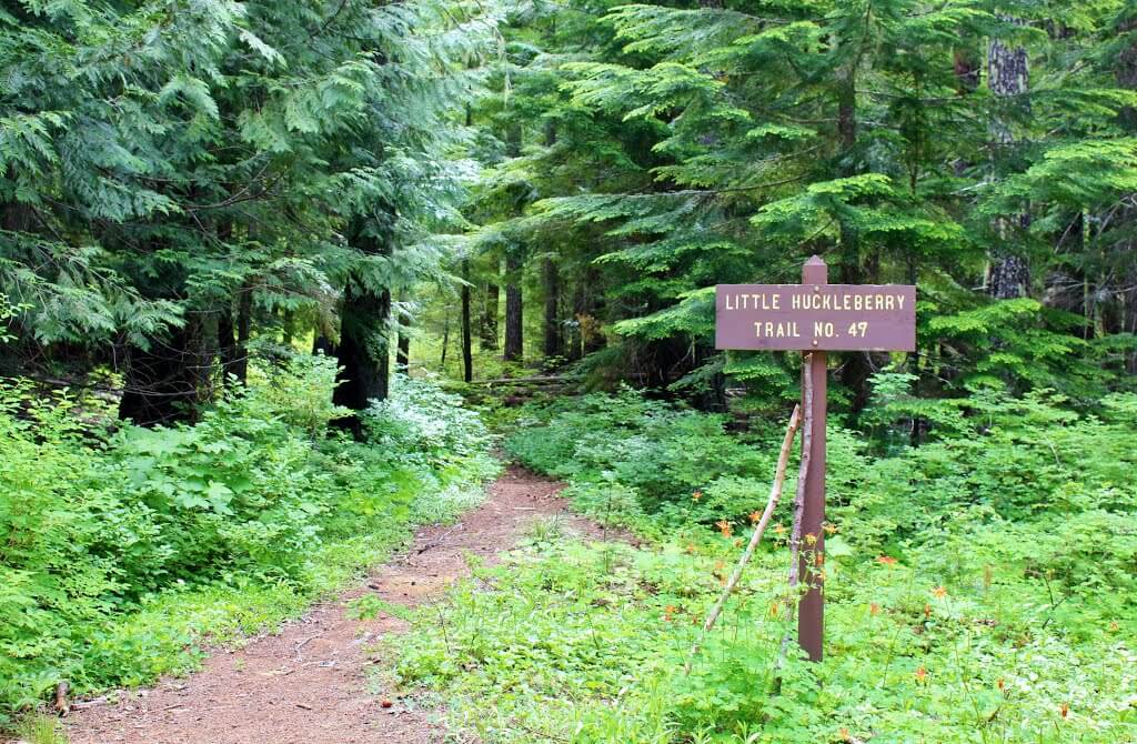
Little Huckleberry

Little Hucklebery Trail entrance.

Source: Washington Hiking: The Complete Guide to More than 400 Hikes

Closed since February due to damage from a major storm, the Beacon Rock State Park Trail was recently reopened to hikers on May 14th, just in time for summer hiking.

Beacon Rock gives an unparalleled view of the Columbia River Gorge. Hikers can now enjoy the mild, albeit steep, walk up the trail along with the rich history of the Gorge.

Beacon Rock

Beacon Rock, from the bottom of the trail. Photo by Haley Childers.

About Beacon Rock

The historic rock is the remains of the core of an ancient volcano, and was rumored to have been bought in 1915 for only $1.

Beacon Rock is truly a Gorge icon, not to be missed! It is an easy, straight-forward climb with wonderful views in all directions from the top.

Two miles round trip from the base of the Rock to the top and back down; 600′ of elevation. The climb can be done year round, but use caution when conditions are unusually cold, wet, icy or windy. The grade on the trail is gradual with railings all the way up across 17 bridges and 54 switchbacks.

Beacon Rock State Park is located in Washington State, 35 miles east of Vancouver, Washington. The park is a 4,650-acre year-round camping park, which includes 9,500 feet of Columbia River freshwater shoreline. Henry J. Biddle purchased the rock in order to build a trail to the top. The trail was built, and in 1935 his heirs turned the rock over to the state for use as a park. Additional development was done by the Civilian Conservation Corps.

Elevations: The River at this point is about 15′ above sea level. The trailhead is at 250′ and the top of the Rock is at 848′.

For more information, check out the Beacon Rock Climbing Association on Facebook.

https://www.facebook.com/BeaconRockClimbingAssociation/

Article and photos by Haley Childers.


Beacon Rock

Photo by Haley Childers.